Sights and Activities
Below are the places we saw and activities completed while visiting Guatemala:
Guatemala City
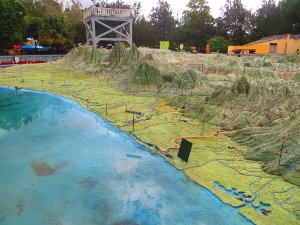
Mapa en Relieve: this large and impressive relief map was located in a park, Parque Minerva. It was constructed in 1904 and shows the country at a scale of 1: 10,000. We were able to view the oceans and dramatic mountains from a viewing platform.
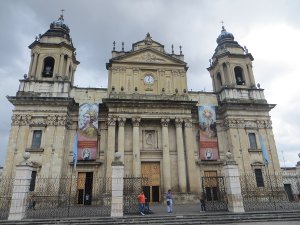
Parque Central: this plaza, Parque Central, is a great place to people watch and that is exactly what we did. We also walked into the colonial cathedral, Catedral Metropolitana.
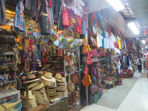
Mercado Central: this central market was destroyed by an earthquake in 1976 and shortly reconstructed. The market specializes in tourist items, but the lower area also sell produce and has several restaurants.
Museo Nacional de Historia: the ‘National Museum of History’ is full of historical artifacts, much of which are pictures and portraits of historic figures.

Centro Civico: the civic center had two buildings with beautiful work of art worth mentioning. The first structure was the Banco de Guatemala (Bank of Guatemala) with tall stone murals by Dagoberto Vasquez depicting the history of the country. The other is the interior of the Municipalidad de Guatemala (City Hall) with large colorful mosaics by Carlos Merida.
Museo Ixchel: this museum houses some beautiful textiles, elaborate costumes, and traditional ceremonies of the Mayan culture found throughout the country.

Museo Popol Vuh: this museum had a large collection of Mayan ceramics and sculptures.
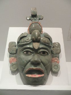
Museo Nacional de Arqueologia y Etnologia: the ‘National Museum of Archaeology and Ethnology’ had several Mayan artifacts, including stone carvings, jade, ceramics, statues, stelae, and a tomb. There were also models depicting different Mayan temples in the country and the last section highlighted the various indigenous people with their traditional costumes, dances, and daily life.
Antigua
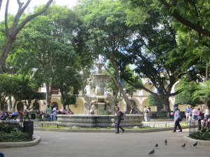
Parque Central: the city’s main plaza is a great gathering place. The main focal point being a fountain built in 1738.
Catedral de Santiago: we were able to view the city’s renovated cathedral and the ruins left of previous versions. It was founded in 1542 and rebuilt several times due to earthquakes.
Palacio de los Capitanes Generales: the ‘Palace of the Captain’s General’ was built beginning in 1558 and served as the governmental center of all Central America from Chiapas to Costa Rica until 1773.
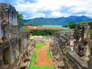
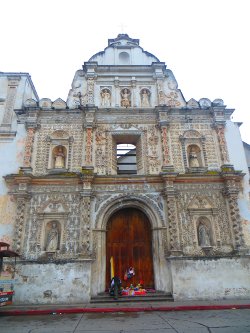
Iglesia de San Francisco: we visited this church from the exterior and interior. It dates from the mid-16th century, but little of the original building remains.
Iglesia y Convento de Santo Domingo: this ruined monastery can be traced back to 1538 when the Dominicans arrived in Guatemala. We walked through the immense complex that was destroyed in a 1773 earthquake. Now, the ruins are part of and also form a luxurious hotel that has up-kept the complex in great condition.
Convento de Capuchinas: this convent was founded in 1736 by nuns from Madrid. Similar to many colonial buildings in the city, it was also destroyed by repeated earthquakes. We were able to tour the ruins that remain, along with the beautiful courtyard with a functioning fountain.

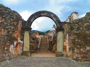
Arco de Santa Catalina: this 17th century archway was originally part of a convent that connected it to a school across the street.
Iglesia y Convento de Nuestra Señora de la Merced: we went inside this baroque-style church, that unlike other colonial churches in the city, this one has been fully restored and functioning as a house of worship. The church is easily recognizable with its yellow pastel color.
Colegio de San Jeronimo: we roamed the grounds of the ruins of this college built in 1757 by friars of the Merced order.

Casa del Tejido Antiguo: this place was a museum, market, and workshop all in one with exhibits on regional outfits and weaving techniques. We were given a tour by one of the employees who explained to us that it is a co-op of several women that weave and sell their product.
Iglesia y Convento de la Recoleccion: this was the last of several ruined churches and convents we toured. This one was originally built between 1701 and 1708 and destroyed in the 1773 earthquake.
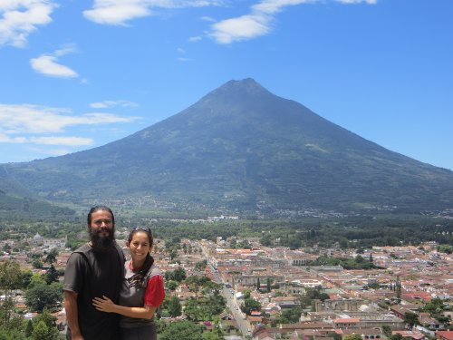
Cerro de la Cruz: one morning we hiked up to the ‘Hill of the Cross’ that offered fantastic views over the city and Volcan Agua (Water Volcano).
Santa Lucia Cotzumalguapa
Museo El Baul: this open-air museum houses several Pipil and Olmec stone sculptures collected from neighboring sugarcane fields.
Museo Cultura Cotzumalguapa: this indoor museum is full of sculptures, ceramics, and other indigenous artifacts found throughout the region.
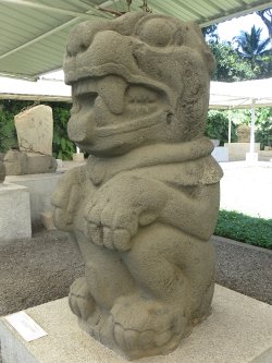
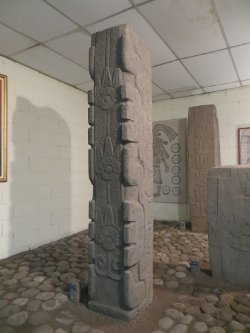
El Baul Hilltop Site: this archaeological site also continues to function as a place of worship for locals. People have been coming for over 1400 years to pay their respect to the two idols that have been left in its original place. The site is surrounded by a beautiful mountainous landscape. One of the sculptures is a half-buried giant head that we have seen in other locations made by the Olmecs. The other stone is a carving of a human figure with circles around it.

Panajachel
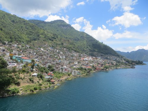
This lakeside village has grown fast due to the many tourists that have discovered Lago de Atitlan (Lake Atitlan). The main thoroughfare is filled with tourist restaurants and travel agencies, usually mestizo (Mixed of European and Indigenous descent) locals attending them, and indigenous, Kaqchiquel and Tz’utujil Maya, selling their handicrafts. The couple of days we were in this village, we decided to venture off and hiked about two hours passing through the villages of Santa Catarina Palopo and San Antonio Palopo. These smaller, more authentic villages, where the indigenous people still wear their traditional clothing, were a lot more pleasant than Panajachel. The walk also gave us great lookout views of the lake and surrounding mountains.

San Marcos
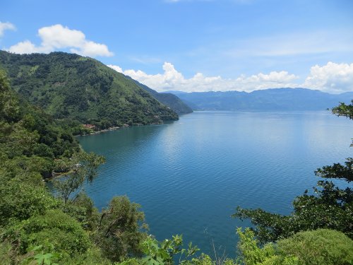
This village was one of the nicer ones we stayed in. It was really laid back and not many tourists or even locals. We spent some days here relaxing and taking some hikes. One two-and-a-half-hour hike lead us through the villages of San Pablo La Laguna, San Juan La Laguna, and San Pedro La Laguna. Another of the same length through the villages of Tzununa, Jaibalito, and Santa Cruz La Laguna. The first hike was through a paved road passing more developed villages. The latter hike passed more remote villages, which were only access by foot or boat. This second hike also passed through corn fields and some forested areas. These hikes were one directional, we would go back on a boat taxi that would come around every so often circulating the lake. Both hikes offered spectacular views of the lake and the mountainous surroundings. Throughout our walks, we encountered very friendly local people that would salute us as we passed.
Santiago Atitlan
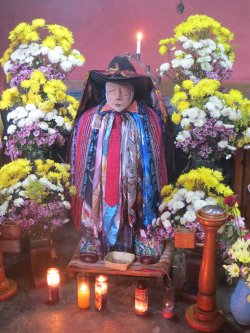
Maximon: Santiago Atitlan was the last village we visited in the Lago de Atitlan (Lake Atitlan) region. This village is home to Maximon, an idol that is housed by a cofradia (a religious brotherhood). The idol in this village is a wooden figure dressed in scarves, a hat, and a cigar. It took a little bit of asking around to find him, because Maximom moves to a different home every year after Easter week. The locals worship him by giving him offerings of cigarettes, liquor, or candles.
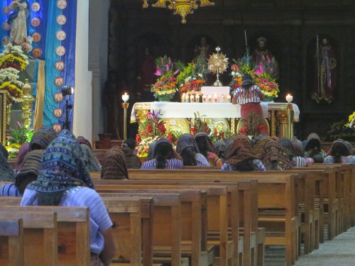
Iglesia Parroquial Santiago Apostol: we went inside this church located on the main square. The decorations and religious artifacts have a notably indigenous connotation. For example, the figures of corn, which the Mayan believed humans came from corn.
Quetzaltenango
Parque Centro America: this is Xela’s, as the city is also known, central plaza.
Catedral del Espiritu Santo: the ‘Holy Spirit Cathedral’ is also known as the Quetzaltenango Cathedral that was founded by Spaniards shortly after conquering the city.
Museo de Historia Natural: housed in the Casa de la Cultura, the ‘Museum of Natural History’ at the time we visited only had some artwork displayed. It seemed as if much of the exhibits were closed.
Templo de Minerva: built by the dictator Estrada Cabrera to honor the Roman goddess of education and to inspire Guatemalans to new heights of learning.
Laguna Chicabal: we hiked about an hour-and-a-half one-way to reach this magical lake hidden inside the crater of the Chicabal Volcano. At an elevation of 2712m (8898 ft), the lake is surrounded by a cloud forest that made the hike very pleasant. It is considered a sacred place for the local indigenous and we were able to witness it when no one was around with such a tranquility that made us understand why it was believed to be so spiritual. We noticed flowers on four sides of the lake, as we approached one set, we realized that they were altars located on the four cardinal points most likely left by worshippers.
Laguna Chicabal
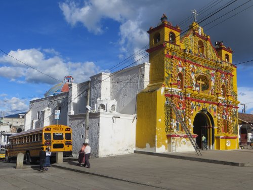
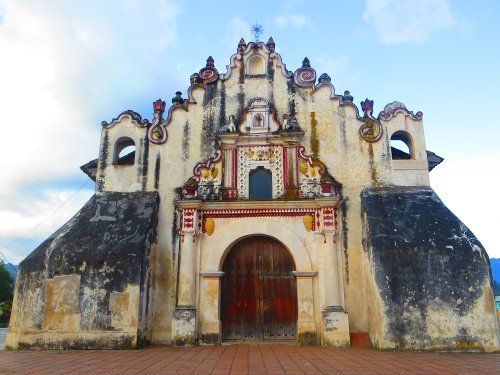
San Andres Xecul: this small town located just outside the city is famous for its brightly colored church. The church painted a flashy yellow with saints, angles, and flowers painted with other bright colors made for great pictures, not to mention the beautiful blue sky enhanced the effect.
Salcaja: another nearby town with a well-known church, Church of San Jacinto, that was founded in 1524. It was the first church to be built in Central America and after so many years and earthquakes it still is in relatively good condition.
Chichicastenango
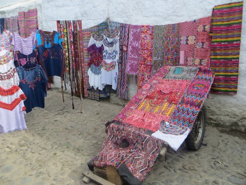
Market: this town has one of the largest markets in the country. It takes place twice a week, Sunday being the biggest. At first glance, the market appears to be for foreigners, since most of the outer stalls have souvenirs and other touristy items, but if you dig deeper and make your way through the chaos you will find items for local needs.

Iglesia de Santo Tomas: theoretically this church is Catholic, but the rituals performed here are a mixture of the Christian faith and traditional Mayan belief. The church dates back to 1540 and during market days the steps leading to the main entrance is full of incense and people praying.
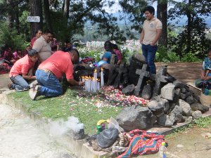
Pascual Abaj: we hike up this hill where a ‘Sacrifice Stone’ is used as a shrine for the local indigenous. When we arrived, there were a group of people gathered around the stone. We asked what was the significance of their visit and they politely replied that they were praying for well wishes and that they would come up every week right before the celebration of the city’s annual festival. They were lighting candles, burning incense, and flowers were spread throughout in what appeared to be a joyful, nonchalant offering.
Lanquin
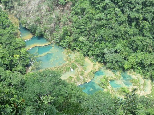
Semuc Champey: Mother Nature created this natural bridge made of limestone that spans 300m (984 ft) over the Cahabon River, resulting in an underground river, and on top of the bridge the rain water accumulates to form incredible turquoise pools. Semuc Champey in the local language, Q’eqchi, means ‘where the river hides under the earth.’ We took a hike to a lookout point and the overall view of the site is amazing, we were able to see all the pools from a bird’s perpective. After hiking back down, we spent the rest of the day swimming back and forth through all the pools.
Flores
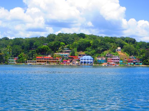
Flores is located on an island in Lago de Peten Itza (Lake Peten Itza). With many hotels and travel agencies, it accommodates to tourists on their way or coming back to the many Mayan temples and tourist attractions in the surroundings. A causeway connects the island to the mainland town of Santa Elena, where we were able to find all the local amenities, such as banks and supermarkets. We toured the perimeter of the small island on foot in a short period, admiring the lake views, but the reality is that we were here, just like any other tourist, as a jumping off point to see Tikal.
Tikal National Park
Museo Tikal: we arrived to the national park in the afternoon and saw two museums, this first small museum had several Mayan artifacts, such as carved jade, inscribed bones, and ceramics, found in burial grounds at the site.
Museo Litico: the second museum was a larger one with a number of stelae, other carved stones, and photographs of the jungle-covered temples in various stages of discovery in the 19th century. Just outside the museum was a scaled model showing how Tikal would have looked around 800 AD.
As mentioned earlier, we arrived to the National Park in the afternoon and after setting up our tent we visited the above museums. The entry ticket allowed us to enter the main temple site an hour before closing and still use the ticket the next day. We did just that, taking some pictures of Temple I and II, and then hurrying up to Temple IV to see the sunset, but unfortunately it was really cloudy, we even felt some drops of rain. We still enjoyed a towering view over the tropical jungle, howler monkeys, and a lighting and thunder show. It is stunning how the Mayans built these pyramids that poke over the jungle’s canopy and at a distance we saw other mounds that may possibly be other temples. The steep temples found in Tikal reach up to 61m (200 ft) in height and some have been partially restored.
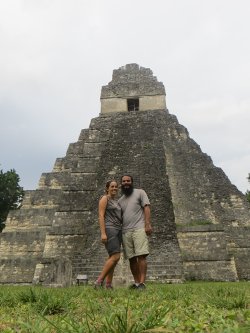
The Mayan would build these temples as burials over kings and layer different temples over each other to be able to get to great heights. It is believed that the Mayan settled here around 700 BC and that by the Classic period (about 250 AD), it had become an important, very religious, and commercial city. Tikal’s power diminished by 900 AD, part of the mysterious general collapse of the lowland Mayan civilization. Tikal was declared a Unesco World Heritage Site in 1979. The next day we woke up at sunrise to reenter the magical jungle and view the temples again. We were not only mesmerized by the Mayan structures, we also were treated to sounds of many tropical birds, seeing a toucan, a woodpecker, and various other birds.
Tikal National Park
