Mexico

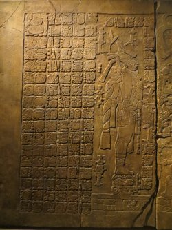
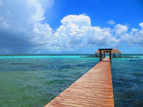
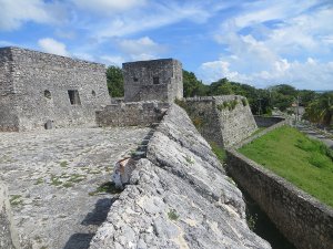
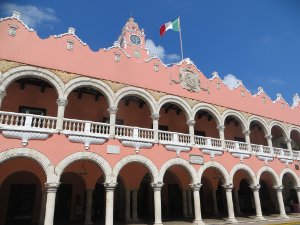
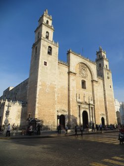
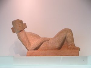
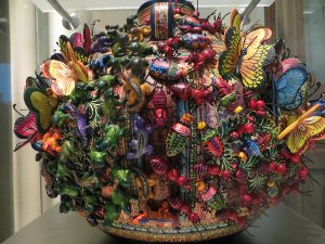
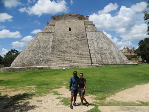
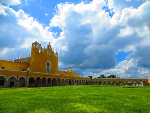
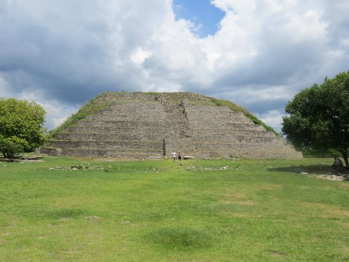
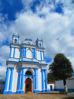
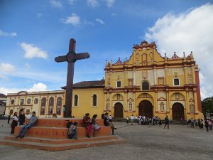
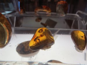
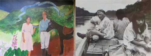
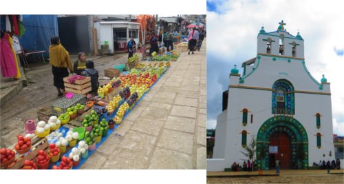
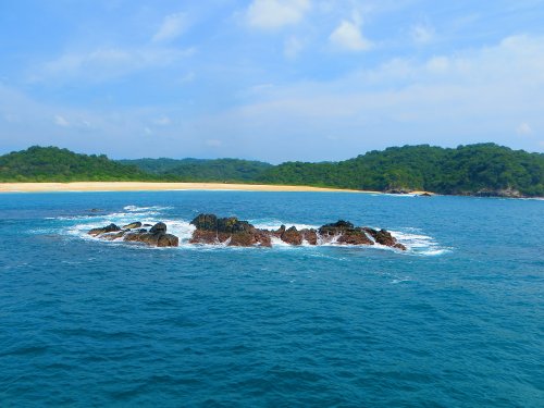
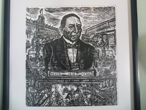
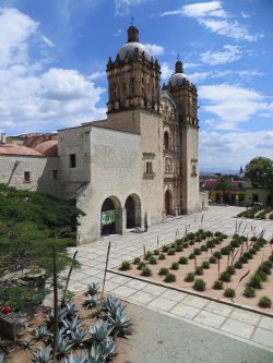
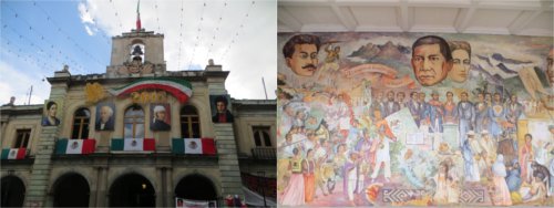
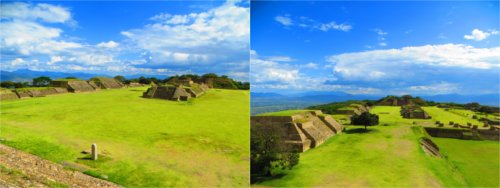
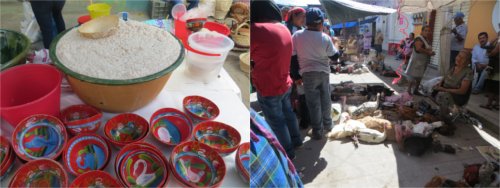
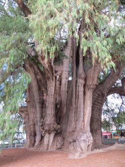
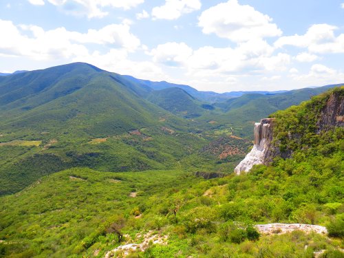
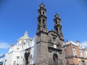
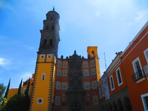
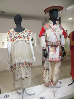
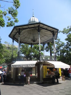
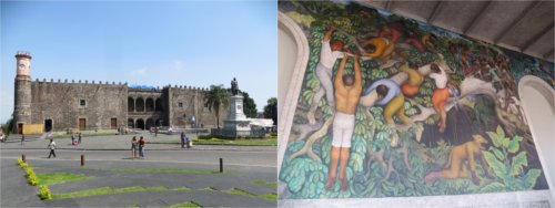
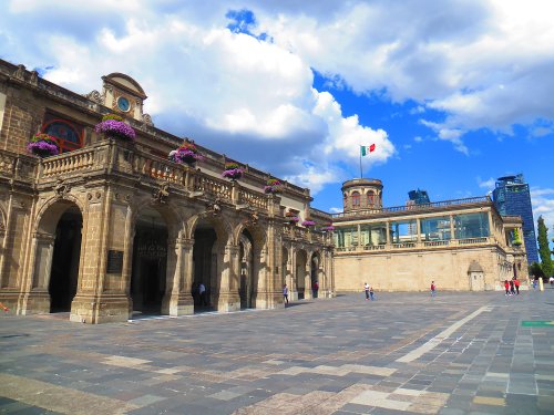
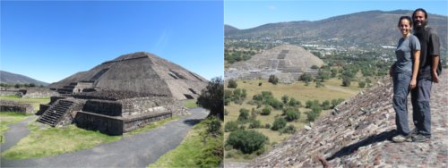
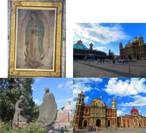
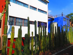
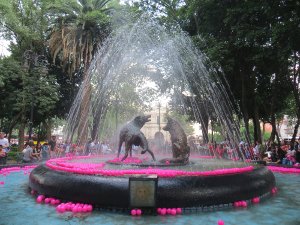
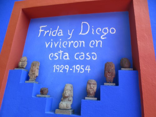
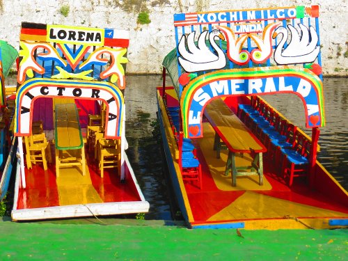
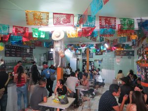
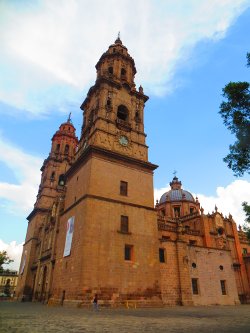
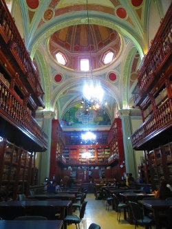
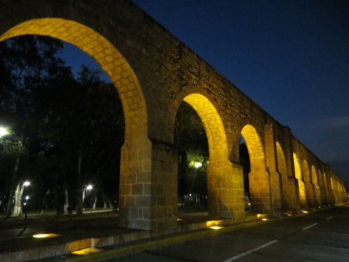
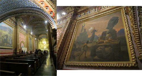
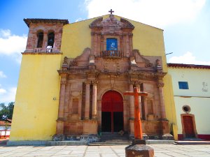
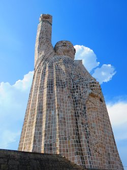
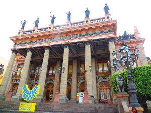
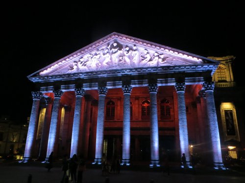
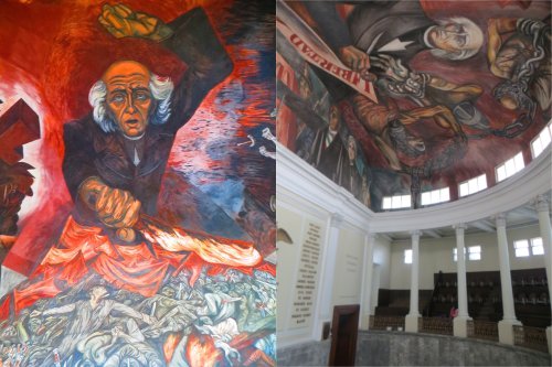
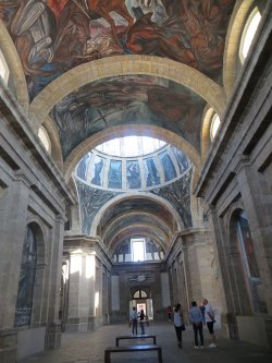
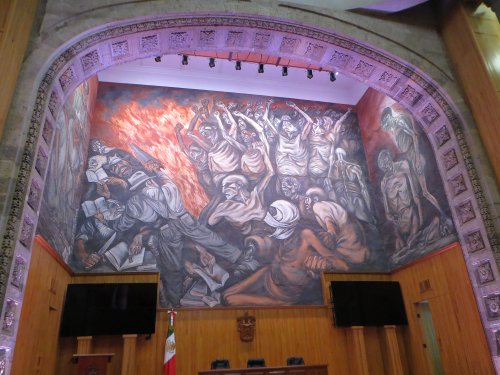
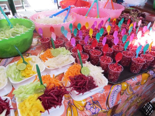
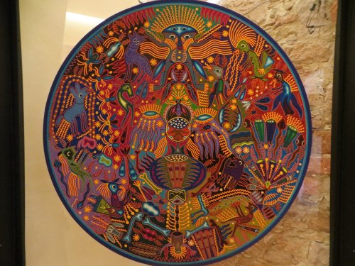
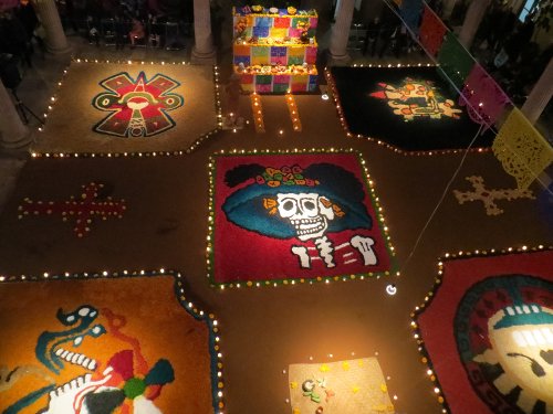
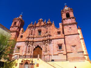
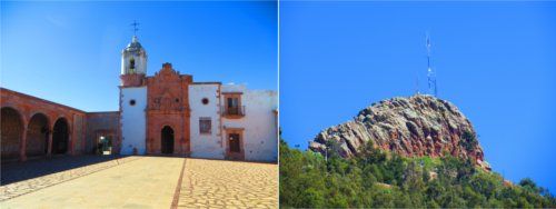
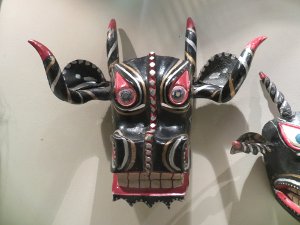
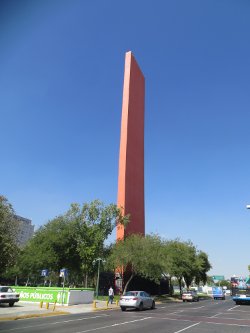
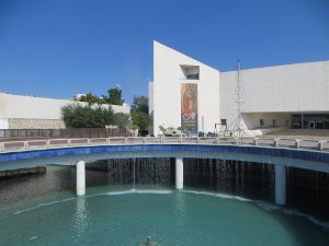
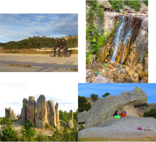
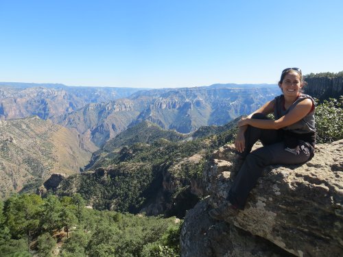
Sights and Activities

Below are the places we saw and activities completed while visiting Mexico:

Chetumal
  • Museo de la Cultura Maya: this nicely designed Mayan museum contains three levels with the main floor representing this world, the lower floor the underworld, and the upper floor the heavens. The exhibits included several explanations, sculptures, temple models, and murals of Mayan life.

  • Museo de la Ciudad: this “Museum of the City” is small, but well organized with several historic artifacts and photos.

  • Malecon: we walked along the bayside esplanade enjoying the breeze and endless ocean views.

Museo de la Cultura Maya
Laguna Bacalar
  • Bacalar Fortress: this fortress was built by the Spanish to defend themselves. Today, it houses a museum exhibiting the history of the area and the fort. There are also great views of the Bacalar Lagoon.

  • Laguna Bacalar: the Bacalar Lagoon stretches for 60 km (37 miles). We were able to enjoy a swim in the crystalline aqua blue waters with white sand from a communal swimming dock.

  • Cenote Azul: located not too far from the Laguna Bacalar, we were also able to swim in this 90m-deep (295ft) natural swimming hole.

Bacalar Fortress
Cenote Azul
Valladolid
  • Parque Francisco Canton Rosado: a Mayan pyramid once stood in this square, but Spanish conquerors used the stones to build the cathedral and other neighboring buildings. The central point of the square features a fountain, known as “La Mestiza,” a tribute to the Yucatec woman of Mayan and Spanish ancestry.

  • Catedral de San Gervasio: this is the city’s cathedral that was originally built in the 16th century and remodeled in the 18th century.

  • Templo de San Bernardino: this church and convent was constructed between 1552 and 1560 and served dual purposes, a place of worship and a fortress. We saw the complex from the exterior during the day and also went back at night to see a wonderful projected narration of the city’s history.

  • Ek’Balam: these Mayan ruins were once a city that reached its peak in the 8th century. Similar to most Mayan cities it was also mysteriously abandoned. There are still a lot of vegetation that cover the ruins, but what is uncovered is impressive, including a large acropolis that holds a series of separate chambers. From the top of the 32m (105ft) high acropolis you can see miles of jungle.

  • Cenote Samula: one of two underground swimming holes located in the complex, this one featured a large body of water with a large sunray beaming through an opening above.

  • Cenote X’Keken: the second underground swimming hole located in the complex, was larger than the first and with amazing stalactites hanging from the ceiling.

  • Chichen Itza: visiting these amazing ruins was not on our itinerary, since both of us had seen them on previous trips, but our CouchSurfing host was able to get us tickets to visit it at night. We were in awe at the site of the main temple with the full moon as a backdrop! Not mention that the night show projected on the temple was also spectacular!! The Mayans first settled here in the Late-Classic period (600 – 900 AD) and then abandoned. It is believed that it was resettled around the late 10th century and shortly invaded by the Toltecs. The city was completely abandoned in the 14th century and it is now one of the better restored Mayan sites. The temple we were able to view at night is famed for the snake that forms during the equinox, which we were able to view a version of it during the night show with artificial lighting.

Merida
Palacio Municipal
  • Plaza Grande: the city’s main square is full of beautiful trees and like many squares in Latin America, it was also the religious center for the indigenous that lived there prior to the arrival of the Spanish.

  • Palacio Municipal: originally built in 1542, this palace was refurbished in the 1730’s and the 1850’s.

  • Casa de Montejo: located on the south side of the Plaza Grande, this complex dates back to 1549. It originally housed soldiers, but was converted into a mansion that served members of the Montejo family until 1970. Now it houses a bank and a museum with colonial furnishings.

  • Catedral de San Ildefonso: we were able to visit the interior of the city’s cathedral, which began construction in 1561 and completed in 1598.

Catedral de San Ildefonso
Palacio de Gobierno
  • Palacio de Gobierno: this palace was built in 1892 and houses state’s executive government offices. We were able to go inside and view the murals by local artist Fernando Castro Pacheco, which portray the history of the Maya and their interaction with the Spaniards.

  • Iglesia de Jesus: this church is also known as the Church of the Third Order. It was built by Jesuits in 1618 with stones of a destroyed Mayan temple that once occupied the same site.

  • Teatro Peon Contreras: this theater was built between 1900 and 1908. We were able to get some pictures of the exterior.

  • Iglesia de la Mejorada: this Franciscan church was built in the 16th century.

  • Gran Museo del Mundo Maya: this great museum of the Mayan World houses several exhibitions on this amazing culture, such as the natural composition of the Yucatan peninsula with cenotes and underground rivers that the Mayan worshipped. The museum also starts from the beginning of time and how the Earth was created. It then moves into Mayan life, the many languages that they speak today, and display many sculptures and artifacts from their past.

Gran Museo del Mundo Maya
Museum of Popular Art of Yucatan
  • Paseo de Montejo: this is a wide boulevard built in the 19th century, which was a European influence attempt to create a Champs-Elysees in the city.

  • Museo de Arte Popular de Yucatan: this ‘Museum of Popular Art of Yucatan’ exhibits local embroidery, explain how ceramic is made, and display other local folk art.

  • Kabah Ruins: we took an organized tour to the Puuc route, which included the Kabah and Uxmal ruins. Puuc means hills in Yucatec Mayan, which refers to this region of hills in a relatively flat Yucatan peninsula. Kabah was an important Mayan city between 750 and 950 AD. The temples are covered with several masks depicting Chaac, the rain god or sky serpent, with a huge elephant-like nose. A sacbe, a Mayan built cobbled and elevated road, leads from here, through the jungle, to Uxmal and other ceremonial temples. It is believed that the entire peninsula was once connected by these ‘white roads’ made of limestone.

Kabah Ruins
  • Uxmal Ruins: these ruins were also part of an organized tour we took into the Puuc route. Uxmal means ‘thrice built’ in Yucatec Mayan, but the temples were actually constructed five times. The Mayans used their amazing engineering skills to build a series of reservoirs and cisterns to catch and hold water in this dry area. It is believed the Mayans first settled in the area around 600 AD. The temples are known for its intricate geometric mosaics, which are part of regional design called Puuc architecture. Because of the scarcity of water, the temples contained many Chaac masks, similar to the Kabah temples, which as a rain god signified the importance the god had to the region. The main temple in the complex raises to 35m (115ft) high and was built in an unusual oval shape. The temple has been restored to what is believed to have been the fifth version for the Mayans.

Uxmal Ruins
Izamal

Known as the ‘Yellow City,’ this small colonial town contains many buildings painted a bright yellow. This town was once a center for the worship of the Mayan sun god, Kinich-Kakmo, hence the belief of why the buildings are painted yellow. This strong spiritual presence provoked the Spaniards to found a city here.

  • Convento de San Antonio de Padua: when the Spaniards conquered Izamal, they destroyed the major Mayan temple and in 1533 began to build from its stones this monastery. We roamed around viewing the beautiful atriums with bright green grass that contrasted magnificently with the yellow paint of the convent and the vibrant blue skies. We entered a small museum that is dedicated to Pope John Paul II’s visit to the monastery in 1933.

  • Kinich-Kakmo Ruins: three of the town’s original 12 Mayan pyramids have been partially restored. The largest is this 34m (112ft) high temple, which we were able to hike up to and get views of the town.

Convento de San Antonio de Padua
Kinich-Kakmo Ruins
Palenque
  • Palenque Ruins: the name of these ruins, Palenque, means palisade in Spanish and has no relation to the city’s ancient name, which is believed to have been Lakamha, or big water in English. Palenque was first occupied around 100 BC, and flourished from around 630 AD to around 740 AD. The ruler responsible for its rise was Pakal, who reigned from 615 AD to 683 AD. He lived to the then-incredible age of 80. Pakal’s son Kan B’alam II (684– 702 AD), continued Palenque’s expansion and artistic development. After 900 AD, Palenque was largely abandoned and in an area that receives heavy rainfall, the ruins overgrown by jungle. The city remained unknown to the Western world until 1746. Many archeaologists have and continue to explore the complex. We hired a guide to take us around the complex of hundreds of structures spread over a 15 sq km (5.8 sq miles), but unfortunately only the central area has been excavated thus far. The ruins are surrounded with a dense jungle filled with creeks, waterfalls, so much flora, and fauna. The complex is within a national park, Parque Nacional Palenque. One unique building is El Palacio, a large structure divided into four courtyards with a maze of corridors and rooms. It contains a tall tower believed to be built to observe the sun and stars.

Palenque Ruins
  • Museo de Sitio: this museum is located within the Palenque Ruins complex and interprets the history of this fascinating city. The museum contains several artifacts found throughout Palenque, but the highlight is the copy of Pakal’s large sarcophagus.

Museo de Sitio
San Cristobal de las Casas
  • Iglesia Santa Lucia: we stayed in a hostel right across this blue and white, neoclassical church that posed for great pictures.

  • Arco del Carmen: this archway dates from the late 17th century and was once the city’s gateway.

Iglesia Santa Lucia
Centro Cultural El Carmen
  • Centro Cultural El Carmen: this colonial building was once a convent that has been turned into a cultural center. We walked around the courtyard and viewed some artwork, as well as the beautiful interior garden.

  • Plaza 31 de Marzo: the city’s main plaza is surrounded with trees and filled with shoe-shiners, newspaper sellers, other street vendors, locals lounging around, and tourists people-watching.

  • Catedral de San Cristobal: the city’s cathedral started construction in 1528, but was not completed until 1815 because of several natural disasters.

  • Iglesia de la Merced: this church was built in 1834 and during our visit the plaza in front was hosting an annual festival dedicated to the church.

Catedral de San Cristobal
Iglesia de la Merced
Museum of Amber in Chiapas
  • Museo del Ambar de Chiapas: this ‘Museum of Amber in Chiapas’ displays many fossilized pine resins that are around 30 million years old. It also explains the process of how it is created and how to tell the difference between fake and real amber.

  • Cafe Museo Cafe: this small museum is located inside a café. It explains the history of coffee and how it is cultivated in Chiapas.

  • Templo & Ex-Convento de Santo Domingo de Guzman: this temple and convent dates to the 16th century, but the baroque-style façade was added in the 17th century.

  • Museo de la Medicina Maya: this ‘Museum of the Mayan Medicine’ explains traditional medicine that is used by many indigenous people, particularly the Tzotzil-Tzeltal Mayan community. Displays include a traditional indigenous church, a midwife assisting at a birth, and a garden with different medicinal plants.

  • Museo de los Altos de Chiapas: this museum displayed some archaeological artifacts found in the region, explanations on the Spanish colonization and evangelization of Chiapas, and a temporary exhibition on local toys.

  • Centro de Textiles del Mundo Maya: in this museum, we learned how the local indigenous make different textiles, such as huipiles. It also displayed different textiles from Mexico and Central America.

Centro de Textiles del Mundo Maya
  • Na Bolom: the former house of Gertrude Duby-Blom, an anthropologist and photographer, and husband, Frans Blom, an archaeologist. Na Bolom means ‘Jaguar House’ in the Tzotzil language. Frans explored and surveyed Mayan sites throughout Chiapas and Gertrude studied, photographed, and fought to protect the Lacandon people and their jungle environment in Eastern Chiapas. At the Blom’s request, the house continues to operate as a museum and research center for the study and support of Chiapas’ indigenous and natural environment. The beautiful house now documents with photographs and archaeological artifacts the European couple’s research. The house also has a large library and garden that grows organic vegetables.

Na Bolom
  • San Juan Chamula: this town is just outside San Cristobal and home to the Chamulans, an independent Tzotzil group. We visited the town on market day, Sunday, when people from the hillside communities sell, shop, and trade anything from livestock and vegetables to cellphone chargers. The fabric of choice to wear for the Chamulans is black wool, we saw many of the women wearing furry wool skirts and the many of the men wearing the same material as jackets. The most interesting reason to visit this town is to see some unique religious practices. We visited the Templo de San Juan, a church where traditional Chamulan Catholicism is practiced. From the outside, the temple looks like any other Catholic church, but in the inside, we witnessed a darkened sanctuary with worshippers lighting hundreds of flickering candles, clouds of incense, people kneeling on pine needle carpets next to soft drinks as offerings, and medicine men and women sacrificing chicken. The ambience was impressive, unfortunately photography was not allowed. Recently, conflicts between these traditional Catholics and converted Evangelicals have resulted in many Evangelicals Chamulans expulsed from their villages.

San Juan Chamula
San Lorenzo Zinacantan
  • San Lorenzo Zinacantan: this town, just outside San Cristobal, is home to the Zinacantan people, who are Tzotzil. We arrived in the early afternoon, too late to see the local market, but we did see the local church, Iglesia de San Lorenzo, where there was a mass taking place. We were also able to see the traditional attire of this community, which for women is pink/purple shawls embroidered with a flower theme and the men would use the same material as tunics, although we also saw some blue tunics.

  • Cerro de San Cristobal: this hill is located on the Westside and offers great views of the city and its surroundings. After walking up all the stairs, we were welcomed by a small church with the same name as the hill.

  • Cerro de Guadalupe: another hill with a gentler slope compared to Cerro de San Cristobal. This hill is located on the Eastside of the city and also offers views and a church.

Huatulco
  • Bahias de Huatulco: we were fortunate to visit this coastal resort and get a few days on the beaches. This coast has boomed in the last decades, previously there was only one small fishing village. The developers have gone the green route in evolving these sets of bays, we were told that it is one of the more sustainable projects not only in Mexico, but also in the world. The area known as ‘Huatulco Bays’ stretches 25 km (15 miles) with nine bays and over 35 beautiful, sandy beaches. We spent our time exploring different beaches such as Chahue Beach, Santa Cruz Beach, Maguey Beach, and Chachacual Beach. The amount of development varies from beach to beach, for example some western beaches are only accessible on foot or by boat and others have several beachside restaurants and hotels. The area also has a national park, Parque Nacional Huatulco, that we did not get a chance to explore. We did take a Seven Bay Tour on a catamaran that sailed through several bays and made two stops to swim and enjoy the crystalline waters.

Bahias de Huatulco
Oaxaca
  • Museo Casa de Juarez: this museum is the former house of Antonio Salanueva, a priest and bookbinder, that took in Benito Juarez, a great 19th century Mexican president, during his youth. Juarez was born in a small village in the mountains outside the capital of Oaxaca. At the age of 12, he left his village to study in the city and that is when we arrived with Mr. Salanueva. The museum displays Juarez’s life as husband, father, governor, and president.

Museo Casa de Juarez
Templo de Santo Domingo
  • Templo de Santo Domingo: this baroque church was built between 1570 and 1608 as part of the city’s Dominican monastery. The front plaza is decorated with maguey and other succulents that made for great pictures.

  • Catedral de Oaxaca: the city’s cathedral began construction in 1553 and did not finish until the 18th century due to many earthquakes.

  • Zocalo: the city’s main square is full of life day or night.

  • Museo de las Culturas de Oaxaca: the ‘Museum of the Oaxacan Cultures’ is housed in the monastery adjoining the Templo de Santo Domingo. The large museum exhibits 14 rooms of the state’s history from the first indigenous to the colonial period, independence, and other current events.

  • Calle Alcala: this pedestrian street runs from Templo de Santo Domingo to the cathedral and is filled with colonial buildings that house shops, art galleries, museums, cafes, bars, and restaurants.

Museum of the Oaxacan Cultures
State Government Palace
  • Palacio de Gobierno: this 19th century State Government Palace is located on the South part of the Zocalo. It houses the Museo del Palacio (Palace Museum), which displays several art exhibits, an interactive exhibition on the universe, an educational biodiversity exposition, a large mural located in the building’s staircase painted by Arturo Garcia Bustos that depicts Oaxacan history, and the world’s largest tortilla decorated with the history of Mexico by Enrique Ramos.

  • Centro Cultural San Pablo: this beautifully remodeled ex-convent with a modern design has been turned into a cultural center. The complex now has several art exhibits and a café.

  • Museo Textil de Oaxaca: this ‘Museum of Oaxacan Textiles’ has a small exhibition on local traditional textiles.

  • La Mano Magica: this commercial art gallery contained expensive paintings from well known Mexican artists.

  • Centro Fotografico Alvarez Bravo: this photo gallery displayed various work by international photographers.

  • Museo Rufino Tamayo: this museum displayed a large collection of pre-hispanic stone sculptures and ceramics that were nicely displayed in well-lit rooms. The collection was donated to the city by its most famous artist, Rufino Tamayo.

Museo Rufino Tamayo
  • Museo de los Pintores Oaxaqueños: this ‘Museum of Oaxacan Painters’ display modern art from local artists.

  • Mercado 20 de Noviembre: we had lunch twice and dinner once on different days in this market, but we could have eaten there for days! There are several small restaurants serving local traditional cuisine and a carnivore’s paradise in the the Pasillo de Carnes Asadas (Grilled Meat Passage), where a dozen stands specialize in grilling local meats.

  • Monte Alban Ruins: this ancient Zapotec city is just West of Oaxaca on a flattened hilltop 400m (1312ft) above the valley floor. The development of Monte Alban is categorized in five phases. It is believed that Monte Alban was first occupied around 500 BC and from this time until 200 BC is known as Monte Alban I (phase 1). The first phase is when they first started to level the hilltop, build some temples and palaces, and a population of about 10,000 people. Archaeologists have found hieroglyphs that could have meant that the Zapotecs were the first people in Mexico to use a developed writing system and written calendar. Phase 2, (Monte Alban II), occurred between 200 BC and 300 AD, a time where the city came to dominate more of the region. The peak of the city came from about 300 AD to 700 AD, Monte Alban III, when the population reached 25,000. Monte Alban IV, between 700 AD and 950 AD, saw the city abandoned. The final phase, Monte Alban V, between 950 and 1521, saw minimal activity, although the Mixtecs arriving from the Northwest of Oaxaca reused some old tombs. We were able to roam the grounds through the ruined temples, palaces, platforms, and ball court all centered around the Gran Plaza, the heart of Monte Alban. Throughout the site we were able to witness 360-degree panoramic views over the city, valleys, and distant mountains.

Monte Alban Ruins
Tlacolula Market
  • Tlacolula: this town, outside of Oaxaca, is known to have the largest market in the Central Valley. We went on market day, Sunday, to observe the selling of local produce, local crafts, and other goods. As well as try the local specialty food and see the church, the 16th-century Capilla del Santo Cristo.

  • El Tule Tree: just outside the city, in a small town called El Tule, lies a giant 2000-year-old tree. This Montezuma Cypress tree is known locally as the biggest tree in the world.

  • Hierve el Agua: at an elevation of 1800m (5906ft), these bubbling mineral springs run into natural infinity pools right on a cliff’s edge with spectacular panoramic views. This water, with all its minerals, dribbling off the cliffs has created formations that appear like huge frozen waterfalls. The site’s name, ‘The Water Boils,’ is inaccurate since the water comes out cool, but the name might have been received due to the bubbles made when the water comes out of the spring. By taking a short hike, we were able to get various panoramic views of the petrified waterfalls.

El Tule Tree
Hierve el Agua
Puebla
  • Zocalo: the city’s central plaza was originally a marketplace where bullfights, theater, and hangings occurred. In 1854, it became the tree-filled plaza that people know today.

  • Cathedral: located on the South part of the Zocalo, this baroque cathedral began construction in 1550. We were able to enter the cathedral that appears on Mexico’s 500-peso bill.

  • Casa de la Cultura: this cultural center hosts a gorgeous 1646 library, the first public library in the Americas.

  • Iglesia de la Compañia: we went inside this 1767 church that is also known as Espiritu Santo.

Cathedral
Templo de San Cristobal
  • Templo de Santo Domingo: this Dominican church was built between 1650 and 1690. We went inside to observe the Capilla del Rosario that is filled with gold painted angels, vines, and leaves.

  • Mercado de Sabores Poblanos: this food court market serves local specialty food. We were able to eat twice in this relatively modern looking building.

  • Templo de San Cristobal: this church was built in 1604, but its towers were rebuilt in 1957 due to bombings in 1856.

  • Templo de San Francisco: this 16th century church is of plateresque architecture. The tower and façade were added in the 18th century.

Templo de San Francisco
Cuernavaca
  • Recinto de la Catedral: this ‘Cathedral’s Compound’ was built in a fortress-like style starting in 1526. This was one of the country’s earliest Christian missions. The first structure was the Capilla Abierta de San José, an open chapel on the cathedral’s west side. The cathedral itself is named Templo de la Asunción de María. The complex holds two smaller churches, Templo de la Tercera Orden de San Francisco and the Capilla del Carmen.

  • MMAPO: this Museo Morelense de Arte Popular (State of Morelos Museum of Popular Art) showcases state popular art, including chinelos: costumed dancers with upturned chins.

MMAPO
Jardin Juarez
  • Jardin Juarez: adjacent to the Plaza de Armas, this square features a central gazebo designed by Gustave Eiffel.

  • Plaza de Armas: the main city square is known as the only main plaza in the country without a church overlooking it. The square surrounded in the East by the Palacio de Cortes, in the West by Palacio de Gobierno, and in the Northeast and South by restaurants.

  • Palacio de Cortes: this palace was built over Cuauhnahuac pyramids to house Hernan Cortes, the Spanish conquistador, responsible for the downfall of most of Mexico’s indigenous. He resided here until he went back to Spain in 1541. The palace remained with Cortes’ family until the 18th century when it was turned into a prison. At the end of the 19th century, Porfirio Diaz turned it into government offices. Now it is home to the Museo Regional Cuauhnahuac, a story museum highlighting Mexican cultures and history. The highlight of the museum is the Diego Rivera mural that depict scenes from the conquest through the 1910 Revolution.

Palacio de Cortes
Tepoztlan
  • Tepoztlan: this small, lovely town just outside Cuernavaca was filled with weekenders. We did not spend much time in the town itself, but instead ventured on a hike up to Piramide de Tepozteco, a 10m-high (33 ft) pyramid perched on a cliff. The grueling 2.5km-walk (1.6 miles) climbs 400m (1312ft). On a clear day, it would make for great views, unfortunately there was some haze when we arrived, but we were still able to appreciate the surrounding cliffs. The Aztecs built this temple in honor of Tepoztecatl, the god of harvest, fertility, and pulque.

Mexico City
  • Templo de la Santisima Trinidad: this church’s façade has carved busts of the 12 apostles and a representation of Christ with his head in God’s lap.

  • Ex-Teresa Arte Actual: this former 17th century convent is tilted due to city being built over a lake bed. They have made some interior modifications to level the floor and be able to display temporary modern art and music exhibitions.

  • Catedral Metropolitana: this huge cathedral measures 109m long, 59m wide, and 65m high (358ft x 194ft x 213ft). Construction started in 1573 and remained a work in progress during the entire colonial period.

Templo de la Santisima Trinidad
Catedral Metropolitana
  • Zocalo: the heart of the city, this square is also known as Plaza de la Constitucion and measures 220m by 240m (722ft by 787ft), one of the largest squares in the world. The square has served for various purposes throughout the years, including protests, concerts, ice skating rink, and much more.

  • Palacio de Iturbide: this 18th century baroque palace was built for colonial nobility.

  • Templo de San Francisco: this 16th century church is of Franciscan order.

  • Casa de los Azulejos: this beautiful ‘House of Tiles’ dates to 1596 and is filled with Chinese blue tiles on the outside and inside. The Moorish interior now houses a restaurant.

  • Torre Latinoamericana: this was Latin America’s tallest building when constructed in 1956.

House of Tiles
Palacio Nacional
  • Palacio Nacional: the Aztec emperor, Moctezuma II, built a temple here and Hernan Cortes destroyed it in 1521, rebuilding the fortress known as ‘National Palace.’ The palace was the sight were the president delivers the shout – ¡Viva Mexico! – on the evening of September 15, 1810 to commemorate independence. Now it is home to the offices of the president and the Federal Treasury. We waited in line not only to see the interior of the palace, but also murals by Diego Rivera painted between 1929 and 1951 that depict Mexican civilization from the arrival of Quetzalcoatl, the Aztec plumed serpent god, to the post-revolutionary period. There are also nine murals that interpret the Aztec way of life before the Spanish conquest.

  • Templo Mayor Ruins: this was the heart of Tenochtitlan, the Mexica (Aztec) city, the spot where it is believed that the Mexica saw their symbolic eagle resting on a cactus with a snake in its beak. This is the symbol of Mexico today and in Mexica belief this was the center of the universe. Before the Spanish demolished the temples, the Mexica sacred area took up the space where the cathedral lies today and blocks North and East of it. These ruins are located to the East of the cathedral and where a double pyramid towered in Mexica times. This area was not excavated until 1978, when construction workers found an eight-ton stone disc of an Aztec goddess that led to demolish colonial buildings and excavate the Templo Mayor. There is also an on-site museum that houses a model of Tenochtitlan, Mexica artifacts found in the area, and an overview of the Mexica civilization.

Templo Mayor Ruins
  • Museo de la Ciudad de Mexico: housed in an 18th century baroque palace, the ‘Museum of Mexico City’ featured several temporary art exhibits of paintings, racism in Mexico, and graffiti.

  • Antiguo Colegio de San Ildefonso: a former 16th century Jesuit college, the building now hosts several temporary art exhibitions. The building is also home to several murals by Diego Rivera, Jose Clemente Orozco, and David Siqueiros from the 1920’s. Rivera’s first mural, La Creacion, was painted on his return from Europe in 1923.

Museo de la Ciudad de Mexico
  • Palacio de Bellas Artes: the ‘Palace of Fine Arts’ started construction in 1905 and was delayed due to construction problems and the Mexican revolution; the building was completed in the 1930’s. The palace hosts temporary art exhibits, which at the time of our visit there was a display on ‘Colors of the Gods:’ how different civilizations around the world used color in their sculptures and ceramics, including the ancient Egyptians and the indigenous of the Americas. There were other temporary art exhibits, but the big treat were the permanent murals by Rufino Tamayo: Mexico Today, and Birth of Nationality, a symbolic depiction of the mestizo (mixed of Spanish and Indigenous ancestry) identity; Diego Rivera: Carnival of Mexican Life, and Man at the Crossroads, originally painted in New York, but it was destroyed due to its anti-capitalist themes and Rivera re-created it here in 1934; David Alfaro Siqueiro: New Democracy; and Jose Clemente Orozco: Catharsis.

Palace of Fine Arts
  • Palacio Postal: the city’s central post office was a early 20th century palace that was built with European materials, such as the bronze railings on the staircase from Florence.

  • Plaza Tolsa: this plaza was named after the sculptor and architect, Manuel Tolsa, that designed the bronze equestrian statue of Spanish King Carlos IV, which is the plaza’s centerpiece, but was covered at the time of our visit. He also completed the Catedral Metropolitana.

  • Alameda Central: this large park was created in the late 1500’s and received its name from the alamo (poplar) trees planted there.

Museo Mural Diego Rivera
  • Museo Mural Diego Rivera: home to one of Diego Rivera’s a 15m-long (49ft) mural, Dream of a Sunday Afternoon in the Alameda Central, painted in 1947. It featured many historic figures who walked in the city starting from colonial times. The museum was built in 1986 to house the mural, after the Hotel del Prado, its original location, was damaged by an earthquake.

  • Paseo de la Reforma: the city’s largest boulevard stretches from Bosque de Chapultepec to the old town center. Along the way there are many statues and sculptures, such as: El Caballito: a bright yellow representation of a horse’s head by sculptor Sebastian; La Diana Cazadora: ‘Diana the Huntress,’ is a 1942 bronze sculpture representing the Archer of the North Star; Monumento a la Independencia: the symbol of Mexico, this ‘Angel’ was sculpted for the independence centennial of 1910, it holds the remains of Miguel Hidalgo, Jose Maria Morelos, Ignacio Allende, and nine other independence heroes; and Monumento a Cuauhtemoc: a monument memorializing the last Aztec emperor.

Paseo de la Reforma
  • Monumento a la Revolucion: originally meant to be a government building, construction was interrupted by the revolution, but instead it was modified and made into the ‘Monument to the Revolution.’ It contains the tombs of revolutionary heroes Pancho Villa, Francisco Madero, Venustiano Carranza, Plutarco Elias Calles, and Lazaro Cardenas. The monument has a 65m-high (213ft) observation deck with wonderful views of the city.

  • Museo Nacional de la Revolucion: located under the Monumento a la Revolucion, this ‘National Museum of the Revolution’ tells the revolutionary history of the country starting from independence until the 1930’s after the installation of the post-revolutionary government. It featured country heroes, such as Francisco Villa, Emilio Zapata, and other.

Monument to the Revolution
National Museum of the Revolution
  • Museo Nacional de Antropologia: this huge anthropology museum, in our opinion Mexico’s best, displays 21 rooms of pre-hispanic cultures and how Mexico’s indigenous descendants live today. The lower floor is dedicated to pre-hispanic civilizations, starting with an introduction to anthropology and the first inhabitants of the Americas to all of the indigenous cultures that existed in the country. The upper floor contains all the rooms with the modern indigenous groups, descendants of the ‘lower floor’ groups, and how they live today. We spent four hours at the museum, which unfortunately was not enough time to appreciate all the information, we had to rush through the entire second floor due to being hungry.

Museo Nacional de Antropologia
Totem Pole Dance
  • Totem Pole Dance: while we were eating after our visit to the Museo Nacional de Antropologia, we were fortunate to see a group of indigenous Totonac people performing their spectacular flying ritual from a 20m-high (66ft) pole, an amazing performance!

Totem Pole Dance

  • Bosque de Chapultepec: the city’s largest park, served as a refuge for the Aztecs before becoming a summer residence for their noble class. Chapultepec is Nahuatl for ‘Hill of Grasshoppers.’ Today, the park contains lakes, a zoo, several museums, the presidential residence, and a former imperial palace, Castillo de Chapultepec. We walked through part of the park enjoying the green sights.

  • Castillo de Chapultepec: this castle is located on top of Chapultepec Hill in the Bosque de Chapultepec. The construction of it started in 1785, but it was not completed until after independence. The castle was the presidential residence until 1939 when President Lazaro Cardenas converted it to the National Museum of History. We did not visit the museum, but we did go up the hill to see the castle and the views of the city.

Castillo de Chapultepec
  • Monumento a Los Niños Heroes: at the Eastern entrance of Bosque de Chapultepec, there are six marble columns commemorating the six ‘boy heroes’ that defended the castle against 8,000 US troops that stormed it on September 13, 1847.

  • Teotihuacan Ruins: located 50km (31 miles) Northeast of Mexico City, in the state of Mexico, we spent five hours roaming through these pre-hispanic ruins. Teotihuacan, the name of the city and the people that built it, was Mexico’s biggest ancient city and the capital of one of the country’s largest pre-hispanic empire. At its prime, the city covered 20 sq km (7.8 sq miles) and now most of the sights that can be seen are along the 2 km (1.2 miles) Calzada de los Muertos (Avenue of the Dead). The main attractions along this avenue are two massive pyramids, the Pyramid of the Sun and the Pyramid of the Moon. It is believed that the city was started in the 1st century AD and the Pyramid of the Sun was completed by 150 AD. The rest of the city was developed between 250 and 600 AD. Social, environmental, and economic factors were the reasons for its decline and eventual collapse in the 8th century. Centuries after its fall, Teotihuacan remained a pilgrimage site for the Aztec royalty. Avenue of the Dead gets its name from the Aztecs who believed the great buildings lining it were vast tombs built by giants for Teotihuacan’s first rulers. We were able to climb up the Pyramid of the Sun, the world’s third largest pyramid after Egypt’s Cheops and Mexico’s pyramid of Cholula, to get a great overview of what remains of the city. We also climbed up to the Pyramid of the Moon that is smaller than the Pyramid of the Sun, but is about the same height because it is built on higher ground. We were also able to visit the two on-site museums, the first Museo de Murales features original and reconstructed murals from Teotihuancan. The other museum, Museo del Sitio, displayed artifacts, ceramics, and skeletons that were found in the area.

Teotihuacan Ruins
  • Basilica de Guadalupe: this was the site where a local indigenous, Juan Diego, claimed in December 1531 that the Virgin Mary appeared before him on the Cerro del Tepeyac (Tepeyac Hill). After numerous sightings, the lady’s image was miraculously decorated on Diego’s coat, causing a bishop to believe the story and build a shrine in her honor. Over the centuries, Nuestra Señora de Guadalupe came to receive credit for all miracles, hugely aiding the acceptance of Catholicism by Mexicans. Despite the protests of some clergy, who saw this as a cult for idolizing this image with the Virgin as a Christianized version of an Aztec goddess, in 1737 the Virgin was officially declared the patron of Mexico. Two centuries later she was named celestial patron of Latin America and empress of the Americas, and in 2002 Juan Diego was canonized by Pope John Paul II. Around 1700, the Basílica de Guadalupe was erected at the site of an earlier temple. But by the 1970s, the old domed building proved inadequate for the quantity of worshippers, so the new Basílica de Nuestra Señora de Guadalupe was built next door. Designed by Pedro Ramírez Vázquez, it has a capacity of more than 40,000 people. The complex now has several chapels spread throughout, including one at the hilltop site where Juan Diego had his vision, Capilla del Cerritio. There also sculptures depicting Juan Diego’s miracle. We also entered the Museo de la Basilica de Guadalupe, a museum filled with colonial and religious art, of course most interpreting the Juan Diego’s vision.

Basilica de Guadalupe
Museo del Tequila y el Mezcal
  • Plaza Garibaldi: this plaza is the center of mariachi bands who come out at night waiting until they get approached by someone who will pay them for a song.

  • Museo del Tequila y el Mezcal: this small museum has exhibits explaining the origins and production processes of tequila and mezcal, the country’s most popular distilled agave drinks. The tour ends with a small tasting of a tequila and a mescal on a rooftop bar overlooking Plaza Garibaldi.

  • Plaza San Jacinto: this plaza is where local artists come out to the Saturday market to try to sell various art pieces. The market attracts an array of people, including ourselves.

  • Iglesia de San Jacinto: just west of the plaza with the same name, this church was built in the 16th century.

  • Museo Casa Estudio Diego Rivera y Frida Kahlo: these houses were designed by Frida Kahlo and Diego Rivera’s friend, architect and painter Juan O’Gorman. The three called this place home from 1934 to 1940. They each had their own separate house. Rivera’s dwelling preserves his upstairs studio, while Frida’s blue house and O’Gorman’s were cleared out for temporary exhibits, which at the time of our visit were dedicated to Rivera’s artifacts and pre-hispanic ceramic collection.

Museo Casa Estudio Diego Rivera y Frida Kahlo
Plaza Hidalgo & Jardin Centenario
  • Plaza Santa Catarina: this small plaza has a picturesque mustard-colored church with the same name.

  • Plaza Hidalgo & Jardin Centenario: these adjacent plazas are the heart of the neighborhood Coyoacan. On the North side of Plaza Hidalgo sits Casa Cortes, where the conquistador established the country’s first municipal seat.

  • Museo Frida Kahlo: the first time we tried entering the ‘Frida Kahlo Museum’ there was a long line that we decided to return another day. When we returned, the line was not as bad, but still waited 45 minutes to enter. This house, known as Casa Azul (Blue House), was where renowned Mexican artist was born, lived, and died. Now turned into a museum, we were able to tour it to learn more about her life through mementos, wardrobe, other personal belongings, and her paintings.

Frida Kahlo Museum
  • Ex-Convento de Churubusco: this ex-convent was the scene of a historic military defeat on August 20, 1847, where Mexican troops defended the US attack over the dispute of Texas annexation. The US invasion was but one example in a long history of foreign intervention in Mexico. This is all explained in the Museo Nacional de las Intervenciones (National Interventions Museum) that is located in this ex-convent. The US eventually took more than half the country away from Mexico. A few years later the French invaded and took control of Mexico after President Benito Juarez suspended interest payments to foreign countries.

  • Xochimilco Canals: these canals are a vivid reminder of the city’s pre-hispanic legacy. Remnants of the chinampas, raised fertile land where indigenous inhabitants grew their food, are still in use today. We took a communal trajinera (gondola) to see the Sunday fiesta atmosphere, when groups rent out private trajineras to glide through the canals eating, drinking, and hiring musicians that hover alongside. Xochimilco is Nahuatl for ‘Place where Flowers Grow.’ In Aztec time, the women would pile up vegetation and mud in the shallow waters of Lake Xochimilco to make the fertile chinampas, which eventually transformed the lake into a series of canals. Approximately 180km (112 miles) of waterways remain today. Xochimilco was designated a Unesco World Heritage site in 1987.

Xochimilco Canals

A Weekend in the Xochimilco Canals

Pulqueria El Templo de Diana
  • Pulqueria El Templo de Diana: we enjoyed a few mugs of pulque in this classic pulqueria (fermented drink made from maguey). There were an assorted amount of flavors, unfortunately we were only able to try a small percentage that they had in offer.

Morelia
  • Fuente Las Tarascas: this fountain is the centerpiece of Plaza Villalongin. The water erupts from a fruit tray held by three topless Tarascan women.

  • Palacio de Gobierno: the 17th century ‘Palace of Government’ was once a seminary.

  • Cathedral: we were able to enter this towering cathedral that took a century to build, between 1640 and 1744.

  • Palacio de Justicia: the ‘Palace of Justice’ was built between 1682 and 1695.

Cathedral
Biblioteca Publica de la Universidad Michoacana
  • Biblioteca Publica de la Universidad Michoacana: this magnificent library is hosted in a 16th century ex-temple, Templo de la Compañía de Jesus. With 22,901 books, the bookshelves rise up to the underside of the domed ceilings!

  • Museo Casa Natal de Morelos: Jose Maria Morelos y Pavon, one of the most important heroes in Mexico’s struggle for independence, was born in this house on September 30, 1765. The city is named after him. This museum exhibits old photos and documents his life.

  • El Acueducto: the city’s preserved aqueduct was built between 1785 and 1788. We were able to see the long monument during the day and the way the arches are illuminated at night.

  • Plaza Morelos: this lonely plaza surrounds Estatua Ecuestre al Patriota Morelos, a statue of Morelos on horseback.

  • Santuario de Guadalupe: this baroque church dates back from 1708 to 1716. The interior is a colorful array of pink, blue, and a lot of gold. There are also several paintings depicting the conversion of the indigenous peoples to Christianity.

El Acueducto
Santuario de Guadalupe
  • Museo Regional Michoacano: this ‘Michoacan Regional Museum’ is housed in an 18th century palace and the exhibits include pre-hispanic artifacts found around the state, the colonization, and the independence.

  • Museo Casa de Morelos: another Morelos museum, this one is housed in his former house. The independence hero, Jose Maria Morelos y Pavon, bought the house in 1801. The museum covers his life story, military campaigns, and the fight for independence.

Patzcuaro
  • Plaza Vasco de Quiroga: the town’s main plaza is framed by old mansions that have been converted to hotels, shops, and restaurants.

  • Templo San Francisco: we were able to visit the interior of this eclectic church with a Christ made of corn paste.

  • Templo San Juan de Dios: this church was founded in the 17th century and remodeled 1841.

Templo San Francisco
House of the Eleven Patios
  • Casa de los Once Patios: this colonial building was a Dominican convent in the 1740’s and now houses handicraft shops. The name states ‘House of the Eleven Patios,’ but over the years the structure has been renovated and now only has five patios.

  • Templo del Sagrario: this church began construction on 1693 and was completed two centuries later.

  • Templo de la Compañia: this 16th century church was a Jesuit training college. The adjacent college building fell into ruins after the expulsion of the Jesuits.

  • Basilica de Nuestra Señora de la Salud: built on a hill over a pre-hispanic site, this church was completed in the 19th century and holds Vasco de Quiroga’s tomb. Quiroga was the first bishop of Michoacan and had a reputation of protecting the indigenous.

Basilica de Nuestra Señora de la Salud
Biblioteca Gertrudis Bocanegra
  • Plaza Gertrudis Bocanegra: this plaza is named after a local heroine who was shot by firing squad in 1818 for her support of the independence movement. There is a statue of her in the center of the plaza.

  • Biblioteca Gertrudis Bocanegra: this town library occupies the interior of a 16th century church. It contains a colorful mural painted by Juan O’Gorman on the rear wall depicting the history of the state of Michoacan from pre-hispanic times until the 1910 revolution.

  • Templo El Santuario: this neoclassical church was built in the early 19th century.

  • Isla Janitzio: we took a ferry to this island located on Lake Patzcuaro that is filled with souvenir shops and seafood restaurants. The car-free island is filled with footpaths that lead to the top of the island, where there is a 40m-high (131ft) statue of independent hero Jose Maria Morelos. The large statue is a vertical museum that lets you climb up a spiral staircase with murals depicting scenes of Morelos’ life on the adjacent walls. We eventually reached the wrist of the statue’s raised arm that offered 360-degree panoramic lake views.

Statue of Jose Maria Morelos
Guanajuato
  • Teatro Cervantes: this colonial style theater was inaugurated in 1979. The small Plaza Allende in front has statues of Don Quixote and Sancho Panza.

  • Templo de San Francisco: this 18th century church was built by Franciscan friars.

  • Teatro Juarez: this beautifully designed theater was built between 1873 and 1903. Usually, it is open to the public for tours, but because we were in the city during the Festival Internacional Cervantino it was only open for rehearsals and during show times.

Teatro Juarez
Basilica de Nuestra Señora de Guanajuato
  • Templo de San Diego: this church was constructed in 1663 and renovated in 1694 and 1780.

  • Basilica de Nuestra Señora de Guanajuato: this church was constructed between 1671 and 1696 and distinguished as a basilica in 1957.

  • Teatro Principal: one of many theaters in the city, this one is home to the symphony orchestra.

  • Templo de la Compañia de Jesus: this Jesuit order church was built beginning 1746 and inaugurated in 1767. Shortly after the Jesuits were expelled from the Americas.

  • Universidad de Guanajuato: the main building of this university is entered by a tall set of stairs that during the Festival Internacional Cervantino at night they would serve as seats for a projected film. The university is made up of over 30,000 students.

  • Mercado Hidalgo: the city’s market is housed in a classical iron structure, which dates from the final stages of the industrial era. The structure was originally designed and built to be a major train station, but the railway was never finalized. Now it is a typical Mexican market with stalls selling a wide range of items.

Universidad de Guanajuato
Mercado Hidalgo
  • Callejon del Beso: the city is known for the many narrow alleyways, but this is the narrowest. The ‘Alleyway of Kisses’ received its name from a local legend that talks about a family that lived on this street and their daughter fell in love with a miner. They were forbidden to see each other, but the miner rented a room opposite their house that had the balconies almost touching each other. From the balconies, they were able to exchange ‘kisses.’

Alleyway of Kisses
  • Festival Internacional Cervantino: without our knowledge, our arrival to the city coincided with the final weekend of this 44th annual festival that we were able to partake in. Although finding a place to stay was complicated and the streets were chaotic during our visit, it was nice to be able to go to a concert and know that the city and country promote these types of cultural activities. The annual festival promotes cultural and artistic events, such as art exhibitions, theater plays, concerts, etc. We were able to see Gabacho Maroc in concert, a Moroccan influenced jazz band.

Gabacho Maroc in the Festival Internacional Cervantino

Museo del Pueblo de Guanajuato
  • Museo del Pueblo de Guanajuato: this museum exhibited several temporary art exhibits by local artists and a permanent mural in a small chapel painted by Jose Chavez Morado depicting the Spanish colonization.

  • Museo y Casa de Diego Rivera: Diego Rivera and his twin brother were born in this house in 1886, his brother died at the age of two. Rivera’s family moved to Mexico City when he was six years old. The house has now been turned into a museum honoring the muralist. The museum exhibits some furniture to represent what life was in his day, there is also a permanent collection of his original work, and several other rooms with temporary art exhibits by various artists.

Museo y Casa de Diego Rivera
  • Museo Regional de Guanajuato Alhondiga de Granaditas: built between 1798 and 1808 as a grain storehouse, the buidling became a fortress in 1810 when 300 Spanish troops and leaders barricaded themselves inside after 20,000 rebels led by Miguel Hidalgo attempted to take Guanajuato. On September 28, 1810, a young miner nicknamed El Pipila tied a stone slab to his back to protected himself from Spanish bullets and set the entrance ablaze. The rebels moved in and killed everyone inside. The structure was later used as an armory, then a school, before it was a prison for 80 years. It became a museum in 1958 that houses temporary art exhibits and the history of the country from the pre-hispanic to colonization, independence, and the time as a republic.

Museo Regional de Guanajuato Alhondiga de Granaditas
Monumento a El Pipila
  • Monumento a El Pipila: this monument honors the hero who torched the Alhondiga gates on September 28, 1810, enabling Hidalgo’s forces to win the first victory of the independence movement. The monument is perched on a hill overlooking the beautiful city that was named a UNESCO World Heritage Site in 1988.

  • Templo La Valenciana: this church situated away from the center started construction in 1765 and completed in 1788.

Guadalajara
  • Templo Nuestra Señora de las Mercedes: we were able to see the interior of this church that was built in 1650.

  • Plaza Guadalajara: the city’s main plaza has great cathedral views and on the North side is Palacio Municipal (City Hall) built between 1949 and 1952, but it looks a lot older. In the stairwell of City Hall, there is a mural by Gabriel Flores depicting the founding of Guadalajara.

  • Cathedral: the cathedral was built in between 1558 and 1618, but the towers were re-built in the mid-19th century after an earthquake toppled them. The interior has colorful stained glass depicting different bible scenes and large Gothic vaults.

Cathedral
Rotunda of the Illustrious Jaliscans
Palace of Justice
  • Rotonda de los Jaliscenses Ilustres: this ‘Rotunda of the Illustrious Jaliscans’ is a park with 20 bronze sculptures of the state’s best writers, architects, revolutionaries, and composer and a rotunda in the center in commemoration.

  • Plaza de la Liberacion: this plaza is behind the cathedral surrounded with colonial buildings, including the Palacio Legislativo, where the state congress meets, and the Palacio de Justicia, the ‘Palace of Justice.’

  • Teatro Degollado: this neoclassical theater is home of the Guadalajara Philharmonic and built between 1856 and 1886.

  • Templo de Santa Maria de Gracia: this church was part of the first female convent in Guadalajara.

  • Templo de San Agustin: built in the 16th century, this baroque church was part of a convent.

Teatro Degollado
Palace of Government
  • Palacio de Gobierno: the ‘Palace of Government’ houses state government offices and finalized construction in 1774. The palace contains two impressive murals by Jose Clemente Orozco. One is the vivid red 1937 mural of Miguel Hidalgo with a torch in one fist while the masses struggle at his feet against communism and fascism. The other is in the Congress Hall depicting Hidalgo, Benito Juarez, Jose Maria Morelos y Pavon, and other historical figures.

  • Basilica de Zapopan: this basilica was built in 1730 and is the pride and joy of the town (Zapopan), an adjacent suburb of Guadalajara.

  • Museo de Huichol: this museum displays various artifacts on the indigenous group known for their peyote rituals and their beautiful beaded artwork.

  • Mercado San Juan de Dios: this large, maze-like market sells everything and has several food stalls specializing in local cuisine, such as torta ahogadas and birria.

  • Plaza Tapatia: this long plaza with a beautiful fountain ends at Instituto Cultural de Cabañas.

Basilica de Zapopan
Museo de Huichol
Cultural Institute of Cabañas
  • Instituto Cultural de Cabañas: this UNESCO World Heritage site, was built between 1805 and 1810. Its first use was an orphanage and home for the disabled, now it is the ‘Cultural Institute of Cabañas.’ There were several temporary art exhibits spread out in the large building filled with internal courtyards. The main attraction are the 57 magnificent murals created by Jose Clemente Orozco inside the Capilla Mayor painted between 1938 and 1939. They depict various scenes from pre-hispanic Jalisco and the Spanish conquest.

  • Plaza de los Mariachis: this plaza is the birthplace of mariachi music. By day, it is like any other plaza with a musician here or there, but by night it is a lively event with various mariachi bands playing for beer and tequila drinking customers.

  • Templo de San Francisco: this church was built by Franciscans between 1668 and 1692.

  • Templo de Aranzazu: this church was built between 1749 and 1752.

  • Templo Expiatorio: this towering gothic temple dates back to 1897. The interior has tall 15m-high (49ft) mosaic stained glass windows.

Templo Expiatorio
Museum of the Arts
  • Museo de las Artes: this ‘Museum of the Arts’ had several temporary art exhibitions, but the main attraction was Paraninfo, an auditorium full Jose Clemente Orozco’s murals.

  • Museo Regional de Guadalajara: this ‘Regional Museum’ hosts exhibits from pre-historic times to the revolution. The natural history collection has an impressive full scale woolly mammoth skeleton and other bones and fossils. There are also many indigenous ceramics, the colonial section has several paintings, and there are guns used during the revolution.

  • Tequila: we had to come visit this world-famous town, the home of one of the most popular liquor in the world. Surrounded by plantations of blue agave and several tequila distilleries, it was difficult to choose just one to visit. We wanted to visit one that was not mainstream, so we went with La Cofradia located just outside the town. We were transported to their beautiful facilities surrounded by mango trees, blue agave, and cacti. They gave us a tour of their complex where they explained the entire process of their 100% organic tequila production from planting and harvesting to cooking and distillery. We were able to see the piñas (heart) of the agave before and after they were cooked. They gave us a tasting of the sweet fibers of the piña after it was cooked, and of course we were able to try the tequila, and also had a margarita.

La Cofradia
  • Tlaquepaque: we spent an evening in this suburb town that is just 7km (4.3 miles) Southeast of downtown Guadalajara. We roamed around Jardin Hidalgo, the town’s main plaza where there were various street food vendors. We also peeked into El Parian where higher end restaurants provide food and drinks to customers and several mariachi bands come around playing music for a fee. We might have been there too late or because it was in the middle of the week that there was not much going on.

  • Tonala: another surburb town, known for its large Thursday and Sunday markets. We went to see the carnival atmosphere of the Thursday market where they had everything for sale. We enjoyed trying the different food they offered.

Jardin Hidalgo
Tonala Market
Zacatecas
  • Ex-Templo de San Agustin: this ex-temple was built for Augustinian monks in the 17th century. It now exhibits temporary art exhibitions.

  • Museo Zacatecano: housed in a former mint, this museum exhibits included pre-hispanic cultures, independence, revolution, the process used in the former mint to make coins, religious art, and Huichol art.

  • Teatro Calderon: this theater was built between 1832 and 1833, then renovated in the 1890’s. It holds plays, concerts, films, and art exhibitions.

Museo Zacatecano
Palace of the Bad Night
  • Palacio de Gobierno: this ‘Palace of Government’ is located in the Plaza de Armas, the city’s main plaza. The 18th century building contains a mural depicting the history of Zacatecas state that was painted in 1970 by Antonio Rodriguez.

  • Palacio de la Mala Noche: this ‘Palace of the Bad Night’ is located across the road from the Plaza de Armas. It was built in the late 18th century and houses state government houses. We went back in the evening to view sawdust rugs and a performance to honor the people that have passed that were part of the ceremonies for the Day of the Dead.

  • Templo de Santo Domingo: this baroque church was built by the Jesuits in the 1740’s, but taken over by the Dominican monks when the Jesuits were expelled in 1767.

Templo de Santo Domingo
  • Cerro de la Bufa: the ‘Bufa Hill’ can be viewed from anywhere in the city. People say that the name is an old Basque word for pig’s bladder, which apparently, that is what the mound looks like. We took a taxi up to the hill, since the cable cars were not running up. There are great views of the city; a small church, La Capilla de la Virgen del Patrocinio, that is named after the patron saint of miners; a museum, Museo Toma de Zacatecas, which we explain in more detail about it below; a plaza with three equestrian statues of the victors of the battle of Zacatecas: Pancho Villa, Felipe Angeles, and Panfilo Natera; and a mausoleum, Mausoleo de los Hombres Ilustres de Zacatecas, with the tombs of Zacatecan heroes from 1841 to the present.

Bufa Hill
Cathedral
  • Museo Toma de Zacatecas: this ‘Museum Taking of Zacatecas’ is located on la Bufa and exhibits the story of 1914 when the city was taken by revolutionary forces after a battle from this and other surrounding bluffs. The attack was led by Pancho Villa and Felipe Angeles. The victory was the gateway to Mexico City.

  • Cathedral: this baroque cathedral was built between 1729 and 1752, and has a beautiful pink-stone façade with detailed carvings.

  • Museo Rafael Coronel: housed in the ruins of a 16th century ex-convent, Ex-Convento de San Francisco, this museum houses Mexican folk art collected by the Zacatecan artist Rafael Coronel, brother of Pedro Coronel and son-in-law of Diego Rivera. The museum displayed several masks, ceramics, puppets, pre-hispanic sculptures, other artwork, and we were able to roam around the gardens of the ex-convent.

Museo Rafael Coronel
Monterrey
  • Gran Plaza: this large plaza is a series of interconnected squares, it is also known as the Macroplaza. It was created in the 1980’s by the demolition of a prime chunk of city-center real estate. The locals claim to be the largest public square in the world with parks, trees, fountains, and great views of the surrounding mountains. We enjoyed a walk through the plaza admiring the views and different building along the way, such as the 70m (230ft) concrete tower Faro del Comercio (Lighthouse of Commerce), Gobierno Municipal, Catedral Metropolitano de Monterrey, Teatro de la Ciudad, Congreso del Estado, Explanada de los Héroes lined with statues of heros, and the 1908 neoclassical Palacio de Gobierno.

Lighthouse of Commerce
Plaza 400 Años
  • Plaza 400 Años: this plaza located in front of a couple museums has a large, inverted fountain and is the start or end of the lovely Paseo Santa Lucia promenade.

  • Paseo Santa Lucia: this promenade stretches 2.4km (1.5 miles) from Plaza 400 Años to Parque Fundidora beside an artificial river. There are ferries that can transport you along the river, but we opted to walk the length of the promenade passing beautiful waterfalls, other water features, and spectacular views of the surrounding mountains.

Paseo Santa Lucia
  • Parque Fundidora: formerly a vast steel factory complex has been transformed into a huge urban park. There are several remnants of the industrial days throughout the park left as sculptures.

  • Horno3: a former steel plant located in Parque Fundidora, has been converted into this impressive high-tech museum devoted to Mexico’s steel industry. The entire steel making process is explained, along with the history of the plant, and a presentation on global warming. There is also an open elevator that takes you to the summit to get a panoramic view of the surroundings.

Horno3
  • Museo de Historia Mexicana: this ‘Museum of Mexican History’ is located in Plaza 400 Años. Due to time, we quickly ran through the exhibits that go through a chronological order of the country’s history.

  • Museo del Noreste: connected to the Museo de Historia Mexicana, this ‘Museum of the Northeast’ explains the history of the Northeast of Mexico including Texas. Unfortunately, we also had to quickly run through the exhibits.

Chihuahua
  • Museo Casa de Juarez: this building housed Benito Juarez during the French invasion. The city became the capital and the place Juarez governed from 1864 to 1866. It is now a museum with artifacts of that time.

Museo Casa de Juarez
Casa Chihuahua
  • Casa Chihuahua: this building was constructed between 1908 and 1910, and has been used as a mint, a Jesuit monastery, a military hospital, a post office, and now is a cultural center. The permanent exhibitions are about the different types of regions and people that make up the state of Chihuahua: dessert, plains, sierra mountains, Mormons, Mennonites, and the Tarahumara. There is also a subterranean dungeon where Miguel Hidalgo was held prior to his execution. The dungeon and the church towering above it were preserved within the later buildings erected on the site. Lastly, there was a temporary photographic exhibition on cholos, or gangsters.

  • Palacio de Gobierno: this 19th century state government building features 1950’s murals by Aaron Piña Mora showing the history of Chihuahua. There is also a small Museo de Hidalgo with various historic artifacts.

  • Plaza de Armas: the city’s main plaza, is host to the baroque cathedral built between 1725 and 1826.

Cathedral
Palacio de Gobierno
Museo Casa de Villa
  • Museo Casa de Villa: this large 48-room mansion belonged to revolutionary hero, Pancho Villa. After his assassination in 1923, 25 of Villa’s ‘wives’ filed claims for his estate. It was determined that Luz Corral de Villa was the legal spouse and awarded the mansion. It became known as Quinta Luz. She opened the house as a museum and now exhibits the life of Pancho Villa, a made-for-Hollywood story of crime, stakeouts, and riches, with personal items and photographs. In the backyard, there is the bullet filled black car the Villa was driving when he was murdered.

  • Casa Sebastian: this gallery contains small scale models of the massive metal sculptures by Chihuahuan artist Sebastian, whose work can be seen in cities worldwide.

Casa Sebastian
Creel
  • Museo Casa de las Artesanias del Estado de Chihuahua: this museum is about the local indigenous group the Tarahumara. Exhibits display their culture, customs, arts, and instruments.

The area around Creel is rich in natural wonders, from waterfalls to surreal rock formations. Therefore, we decided to rent a scooter to take advantage of the time. We first headed to the furthest place we would be able to reach, the bottom of the Copper Canyon where Humira bridge goes over the Urique River. The scenery along the way was stunning. On the way back, we made several stops. The first was at a waterfall, Cascada de Cusarare, a beautiful 30m (98ft) drop. We then had lunch in front of Lake Arakeko, a bluish-green lake surrounded by pine trees and rocks. We continued to reach the Valley of the Monks, a spectacular outcrop of vertical rock formations that inspired its Tarahumara name Bisabírachi, meaning ‘Valley of the Erect Penises.’ Then we came across the Valley of the Frogs and Mushrooms named for its fat-and-squashed and thin-but-big-headed rocks. Our last stop was Cueva de Sebastian, a cave inhabited by 14 Tarahumara. Even though we did fall from the scooter and Gisela suffered some minor injuries, we did enjoy the day.

  • Parque de Aventura Barancas del Cobre: this adventure park is located South of Creel includes traditional zip-lines, one sit-down zip-line that extends 2.5km (1.6 miles) that they claim to be the world’s longest, cable cars, rappelling, and rock climbing. This time we opted just to see the adventurous from a distance and not to do any of the activities and just hike along the canyon top enjoying the amazing views.

Viewpoint
Chihuahua-Pacific Train (Chepe)

To continue enjoying the Copper Canyon we opted to take the Chihuahua-Pacific Train, or known as the Chepe (in Spanish using the initials ‘Ch’ and ‘P’) from Creel to Los Mochis. The reality is that this is the only direct way to go from the mountainous sierras of Northern Mexico to the Pacific, otherwise we would have to make a huge loop in public transportation. The Chepe runs from Chihuahua to Los Mochis daily each way. We caught it from Creel, about the halfway point. The complete train journey is 656km (408 miles) and passes 37 bridges and 86 tunnels. The project was completed in 1961 and reaches a maximum of 2,400m (7,874ft) of elevation. Unfortunately, it doesn’t always run so smoothly, when we took the train we were delayed three hours and really were not able to see a lot of the beautiful scenery due to darkness. Regardless, it was a comfortable way to travel.

La Paz
  • Museo de la Ballena: we took a very informative guided tour of this ‘Museum of the Whale.’ The excellent museum has five rooms with exhibitions on various marine life. There are various skeletons of dolphins, whales, turtles, and other marine animals, as well other hands-on and interactive experiences.

  • Museo Regional de Antropologia e Historia: this ‘Regional Museum of Anthropology and History’ was partially in renovation, but the museum had exhibits on the history of the region from prehistory to the revolution with some nice models of indigenous life.

Museum of the Whale
Malecon
  • Santuario de la Virgen de Guadalupe: this is the city’s largest church, although from the exterior it does not look complete.

  • Malecon: we walked the entire length of this ocean side boardwalk filled with restaurants, bars, and shops.

  • Whale Shark Tour: with our hopes low, after all, this was our third time searching for them on this world trip, we signed up to try to find the largest fish in the world. But not too long after we set sail, we encountered not just one, but about eight of them!! It was juvenile season, but those babies looked huge!! We cannot imagine the size of the full-grown ones. Be sure to read our article on La Paz to see some pictures of them, although it was difficult to get good pictures.

  • Espiritu Santo Island Tour: after our whale shark tour we continued to this island with amazing rock formations, beautiful beaches, and we were able to swim with sea lions. This island, along with 243 others, is a UNESCO World Heritage Site. Be sure to read our article on La Paz to learn more of our experience on the island.

  • Playa Balandra: we spent a few hours swimming and lounging in this beach with relatively shallow waters. Be sure to read our article on La Paz to learn more of our experience on this beach.

Espiritu Santo Island
Playa Balandra
Tijuana
  • Museo de las Californias: this museum chronicles the history of Baja California from prehistoric times to the present. The displays include artwork, dioramas, and scale models to convey the information.

  • Pasaje Rodriguez: this alleyway located in the heart of the restaurant/bar district is a hipster’s paradise, with vibrant murals, cafes, music bars, bookstores, and craft shops.

  • Vinicola L.A. Cetto: we took a tour of this winery that was started by an Italian immigrant who arrived in Baja in 1926. We of course also had a sampling of a variety of their wines. This was a bitter-sweet end to our trip.

Vinicola L.A. Cetto
Facebook